TLCVs likely to develop starting this week — PAGASA
Tropical cyclone-like vortices (TCLVs) are likely to develop starting this week until next week, according to the Philippine Atmospheric, Geophysical and Astronomical Services Administration (PAGASA).
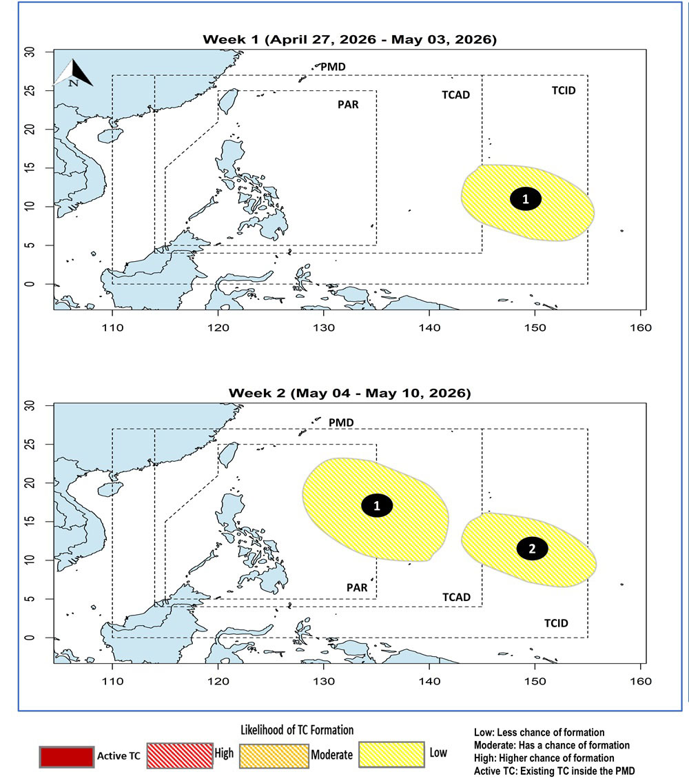
In its latest tropical cyclone threat potential forecast, PAGASA said that a TCLV is likely to develop from Monday to Sunday.
It may emerge over the eastern boundary of the PAGASA Monitoring Domain (PMD), with a low chance of developing into a tropical cyclone.
Two TCLVs are also likely to develop between May 4 and May 10, both of which have a low chance of developing into tropical cyclones.
The first TCLV is likely to enter the northeastern portion of the Philippine Area of Responsibility (PAR), while the second may emerge over the eastern boundary of the PMD.
With this forecast, PAGASA said that the likelihood of tropical cyclone development during the period remains unlikely.
Meanwhile, the easterlies are still likely to affect the country within the next 24 hours, PAGASA said in its 4:00 pm weather forecast.
The easterlies will bring cloudy skies with scattered rains and thunderstorms over Eastern Samar, Southern Leyte, and Dinagat Islands.
It will also affect Surigao del Norte, Surigao del Sur, and Davao Oriental.
PAGASA warned of possible landslides and flash floods due to moderate to occasional heavy rains.
For Metro Manila and the rest of the country, partly cloudy to cloudy skies with isolated rain showers or thunderstorms are expected, also due to Easterlies.
Flash floods and landslides may occur in these areas during severe thunderstorms, PAGASA said. — Edg Adrian A. Eva


